History of San Antonio
Vintage photos of San Antonio roads pave way to understanding city's growth
I must admit to something: On the occasional late night, I go online to browse photos of vintage San Antonio.
Most evenings, the photos could be a place familiar to this native San Antonian, but its the roads that appeal to me the most. Roads, bridges, freeways — the routes that evolved along with the growth of the Alamo City.
I spend extra time on pictures of streets and freeways around my old stomping grounds, Los Angeles Heights. The neighborhood was established decades ago, northwest of the old center city area before San Antonio began its post-war expansion. The community developed along what became Interstate 10.
The "boonies"
My neighborhood was, as my grandfather once put it, “in the boonies” back in the day. So you can imagine how different the roadway that became I-10 looked then.
But there’s no need to imagine. You can view vintage photos at such outlets as The Texas Highway Man, a tremendous resource for historical aspects of Texas roadways as well as present-day transportation projects.
Built by Brian Purcell, a systems architect at a local university, Texas Highway Man features a wealth of information and images from the Texas Department of Transportation and other archival resources.
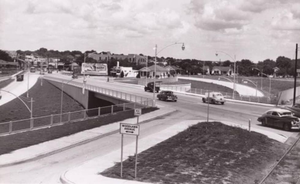
One photo captures action, circa 1950, at Fredericksburg Road where it turned into the old U.S. 87 route as became the “new” I-10 expressway, around Woodlawn Avenue.
I could study images like this for several minutes. Every detail of the surrounding neighborhood interests me. It’s close to Los Angeles Heights, where my grandparents wound up raising three wonderful daughters, and then two pretty cool grandsons in the following decades.
Deco District
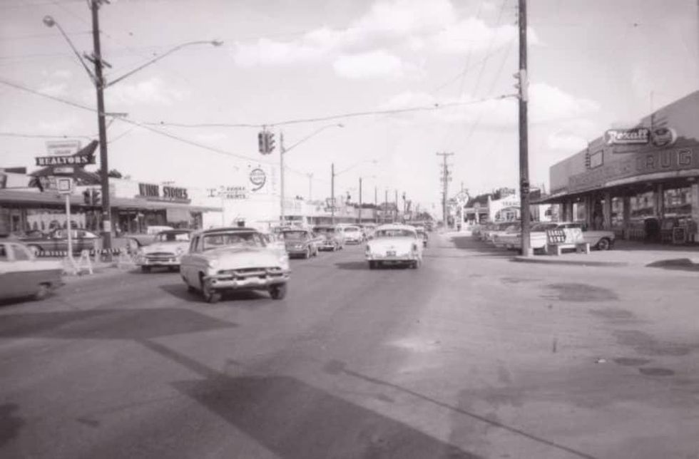
Another photo at Texas Highway Man, one of Fredericksburg Road at Donaldson Avenue in 1959, sparks my imagination. This is the Deco District, a historic community that sprang up as part of the Old Spanish Trail, the first paved east/west U.S. highway that reached both coasts.
Much of the neighborhood’s Art Deco architecture remains. It adds a unique quality, a kind of elegance, to the storefronts, restaurants, theaters, galleries, and other buildings. It’s also a short distance from my childhood home. I could spend a good deal of time peering at the picture, seeing what has changed, what has not. It was a busy streetscape then as it is now.
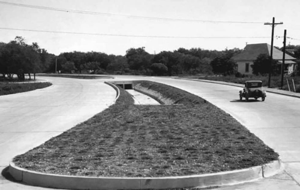
If you’re seeking something with a more striking contrast, check out a photo, circa 1935, of Austin Highway and Broadway in Alamo Heights.
Instead of commercial and apartment buildings and a nearby art museum, it’s still a mostly rural landscape on the verge of urban development. (Also in the boonies, according to my granddad.)
Southtown
Then there’s the 1940 picture of the intersection of South Alamo and South Presa streets. I think of the structures razed or modified at the intersection, removed or changed seemingly eons before the revival of Southtown.
Texas Highway Man also contains a conceptual diagram for a once-proposed interchange between Loop 410 and U.S. 281. Think of it — here could have been a full cloverleaf interchange between the two freeways built in the 1970s or '80s.
A cloverleaf was built at 410 and San Pedro in its place — a cloverleaf that was demolished before the end of the last decade in favor of what we have now in the 281/410 interchange. It’s crazy to think the San Pedro/410 interchange even existed.
If you were to follow TexasHighwayMan on social media, you’ll see another fun feature: a then and now segment. Each week, there’s a pair of photos of a specific roadway or intersection, one from the past, one from the present.
I’m happily distracted, in a sense, by those segments. I just envision what’s in the photographed area now as opposed to what was there then.
As a San Antonio native, indulging in the minutiae of local history is fun. But it also provides a perspective about the city’s growth and evolution. It shows where we’ve been and where we’re going and how.


